


About this app
Introduction
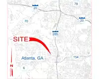
In the world of Building Information Modeling (BIM), Revit has become a popular software choice for architects, engineers, and construction professionals. One of the key advantages of Revit is its ability to integrate with various plugins that enhance its functionality. One such plugin that has caught our attention is Vicinity GIS - New Mexico, US. This plugin offers a collection of CAD Models that consist of real-world, geo-referenced features, specifically tailored for users in New Mexico, US. Let's delve deeper into what Vicinity GIS has to offer and how it can benefit your Revit projects.
(Image by: Methodical, Cad Consulting)
Features and Functionality
Vicinity GIS provides users with a set of CAD Models that represent Federal, State, and local streets, highways, and roads in New Mexico. Each CAD Model is geo-referenced to its respective NAD83 State Plane coordinate system, ensuring accurate placement within your project. The plugin supports both U.S. Survey feet and meters, making it versatile for users in different regions. The CAD Models are in "dwg" format, compatible with all Autodesk product categories, making them easy to integrate into your Revit projects.
One of the standout features of Vicinity GIS is the ability to x-reference the CAD Models into your project design models and x-clip them to show only the specific areas you need. This helps streamline your workflow and focus on relevant information. The models include polylines, text, and hatch entities, organized by Layer, Color, Line Weight, and Style for easy customization. Users can isolate, select, and search for specific features using standard Autodesk AutoCAD commands like "Qselect" and "Find" for text entities.
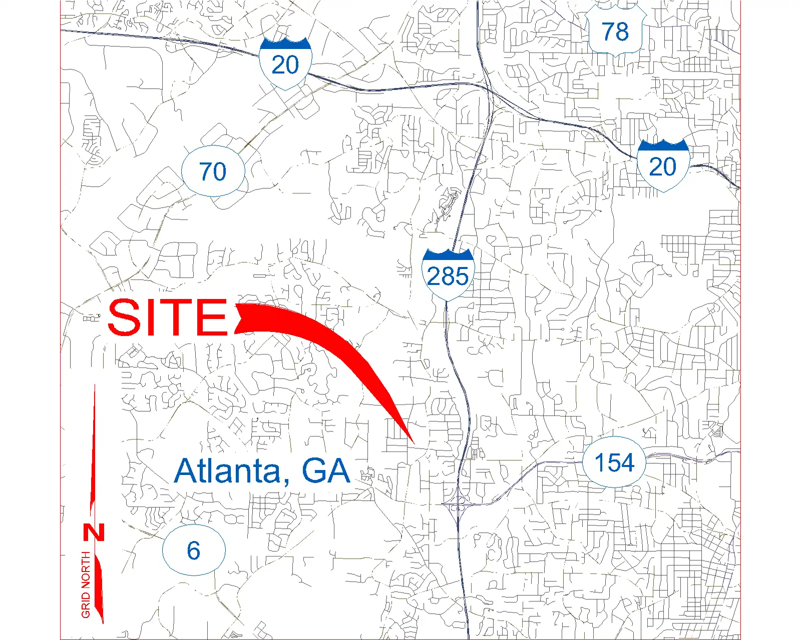
(Image by: Methodical, Cad Consulting)
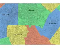
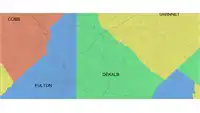
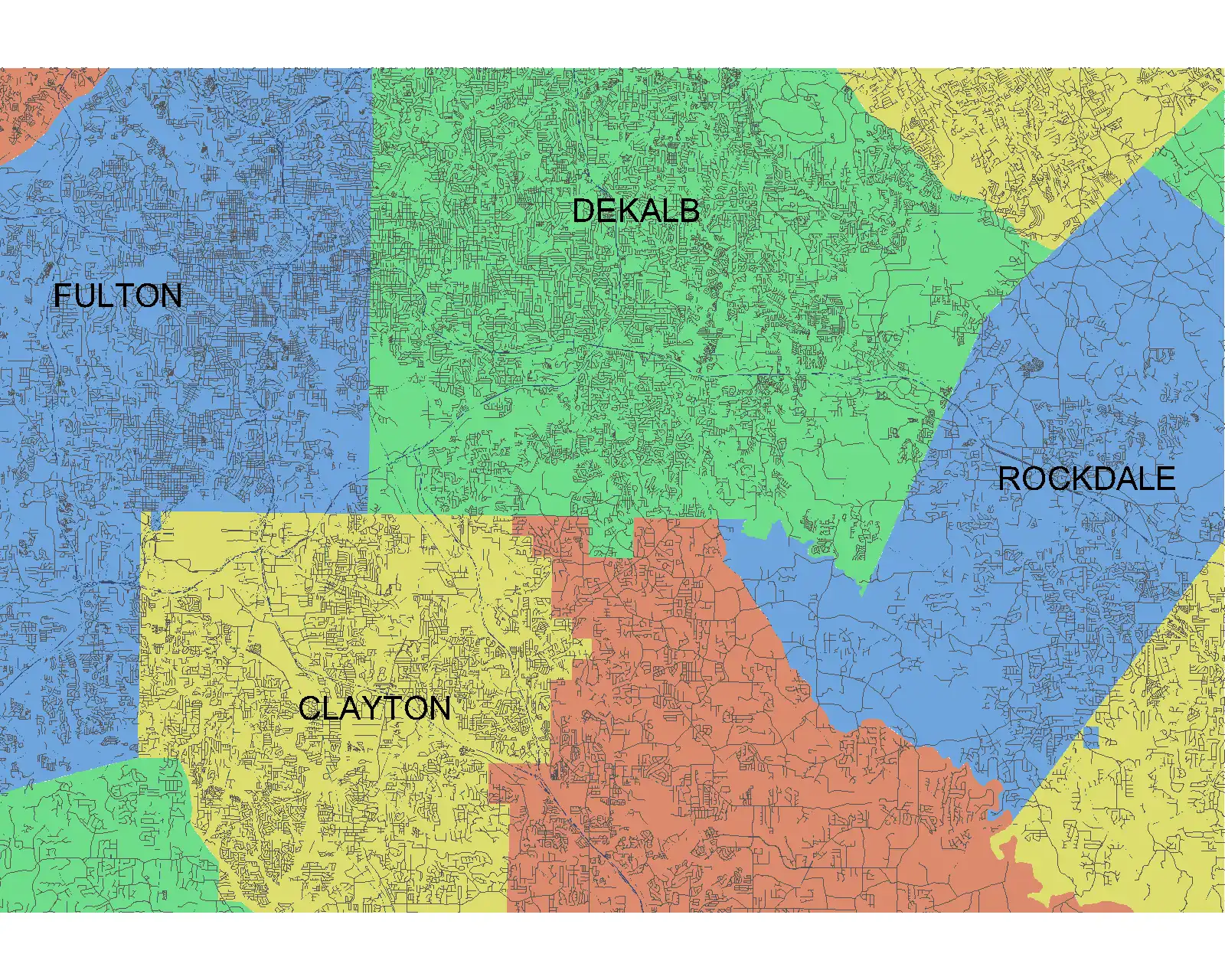
Governmental Administrative Divisions
Another notable aspect of Vicinity GIS is the inclusion of Governmental Administrative divisions such as State, Province, County/Parish, and City. These divisions are represented by hatched areas within the CAD Models, making them easily distinguishable and searchable. This feature is particularly useful for users who need to work with specific administrative boundaries in their projects. It adds an extra layer of detail and context to your design, helping you make more informed decisions.
(Image by: Methodical, Cad Consulting)
Conclusion
Overall, Vicinity GIS - New Mexico, US is a valuable plugin for Revit users who require accurate geo-referenced CAD Models of streets, highways, and roads in New Mexico. The plugin's seamless integration with Revit, along with its user-friendly interface and versatile features, make it a must-have tool for anyone working on projects in the region. The ability to x-reference CAD Models, customize features, and access Governmental Administrative divisions sets Vicinity GIS apart as a comprehensive solution for BIM professionals. If you're looking to enhance your Revit projects with real-world data and improve your workflow efficiency, give Vicinity GIS a try. It's sure to elevate your design experience and help you achieve better results.
(Image by: Methodical, Cad Consulting)