


About this app
Introduction
Vicinity GIS is a powerful Revit plugin that offers a collection of CAD models containing real-world, geo-referenced features representing Federal, State, and local streets, highways, and roads. With each CAD model geo-referenced to its respective NAD83 State Plane coordinate system, in either U.S. Survey feet or meters, this plugin provides a seamless integration of geographic data into your Revit projects. In this review, we will explore the features and benefits of Vicinity GIS and how it can enhance your design workflow.
(Image by: Methodical, Cad Consulting)
Features and Benefits
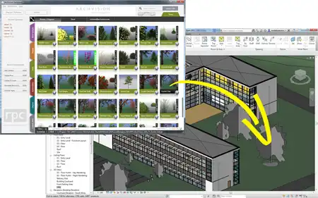
One of the key features of Vicinity GIS is its compatibility with all Autodesk® product categories, thanks to its dwg file format. This universal format is widely used in the Engineering, Architectural, Structural, and Geographic Industries, making it easy to integrate the CAD models into your Revit projects. Whether you are working on a building design, infrastructure project, or urban planning, Vicinity GIS provides a comprehensive library of geo-referenced features that can be inserted or x-referenced into your design models.
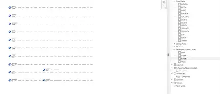
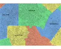
Each CAD model in Vicinity GIS includes polylines, text, and hatch entities, which are organized by Layer, Color, Line Weight, and Style. This level of detail allows you to easily isolate, select, and search for specific features using standard AutoCAD commands like "Qselect" and "Find," making it effortless to navigate through the dataset and find the information you need. Additionally, Governmental Administrative divisions such as States, Provinces, Counties/Parishes, and Cities are represented by hatched areas, providing a clear visual hierarchy that enhances the usability of the CAD models.
By leveraging the geo-referenced features in Vicinity GIS, you can enhance the accuracy and precision of your Revit projects. Whether you are conducting site analysis, creating as-built documentation, or visualizing transportation networks, the inclusion of real-world data can improve the overall quality of your designs. With Vicinity GIS, you can access a wealth of geographic information that complements your architectural and engineering expertise, resulting in more informed decision-making and efficient project delivery.
(Image by: Methodical, Cad Consulting)
Integration with Revit
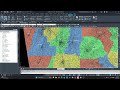
Integrating Vicinity GIS with Revit is a straightforward process that allows you to leverage the geo-referenced CAD models within your BIM environment. By inserting or x-referencing the models into your Revit project, you can seamlessly incorporate the real-world features into your design workflow. The ability to x-clip the CAD models to show only project-specific areas further enhances the customization and flexibility of Vicinity GIS, enabling you to focus on the relevant information for your project.
Whether you are working on a small-scale residential development or a large-scale infrastructure project, Vicinity GIS provides the geographic context that enhances the spatial understanding of your design. The accurate representation of streets, highways, and roads within the CAD models enables you to analyze site conditions, plan transportation routes, and optimize spatial relationships in your Revit projects. By integrating Vicinity GIS into your design process, you can streamline the workflow, improve collaboration with stakeholders, and deliver high-quality designs that meet the demands of modern architecture and engineering.
(Image by: Methodical, Cad Consulting)
Conclusion
Vicinity GIS is a valuable Revit plugin that enriches your design projects with real-world, geo-referenced features. By leveraging the CAD models in Vicinity GIS, you can enhance the accuracy, precision, and spatial understanding of your designs, resulting in more informed decision-making and efficient project delivery. With its compatibility with all Autodesk® product categories, intuitive navigation features, and seamless integration with Revit, Vicinity GIS is a must-have tool for architects, engineers, and designers working on projects that require geographic data. Try Vicinity GIS today and elevate your Revit workflow with real-world context and accuracy.
(Image by: Methodical, Cad Consulting)