


About this app
Introduction
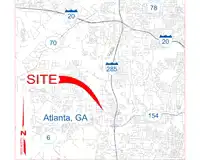
Revit users looking to enhance their design projects with real-world geographic features need look no further than Vicinity GIS - Indiana, US. This innovative plugin offers a collection of CAD Models that are geo-referenced and represent Federal, State, and local streets, highways, and roads. By incorporating these detailed models into their designs, users can create more accurate and visually appealing projects that seamlessly integrate with the surrounding environment.
(Image by: Methodical, Cad Consulting)
Geo-Referenced CAD Models
One of the standout features of Vicinity GIS - Indiana, US is its use of geo-referenced CAD Models. Each model is aligned with the NAD83 State Plane coordinate system, ensuring precision and accuracy in design. Whether you are working in U.S. Survey feet or meters, these models are tailored to meet your specific needs. This level of customization allows users to work comfortably in their preferred units and ensures a seamless design process.
Furthermore, the CAD Models are provided in "dwg" format, which is compatible with all Autodesk® products. This universal format is widely used in Engineering, Architectural, Structural, and Geographic Industries, making it easy to integrate Vicinity GIS models into existing projects. Whether you are inserting or x-referencing these models, the process is straightforward and efficient.
(Image by: Methodical, Cad Consulting)
Feature-Rich Design Elements
Within each CAD Model, users will find a wealth of design elements that enhance the overall visual appeal of their projects. From polylines to text and hatch entities, these features are organized by Layer, Color, Line Weight, and Style. This level of detail allows users to isolate, select, and search for specific elements within the model, using familiar Autodesk® AutoCAD® commands like "Qselect" and "Find" for text entities.
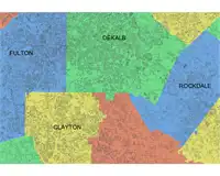
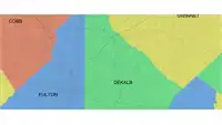
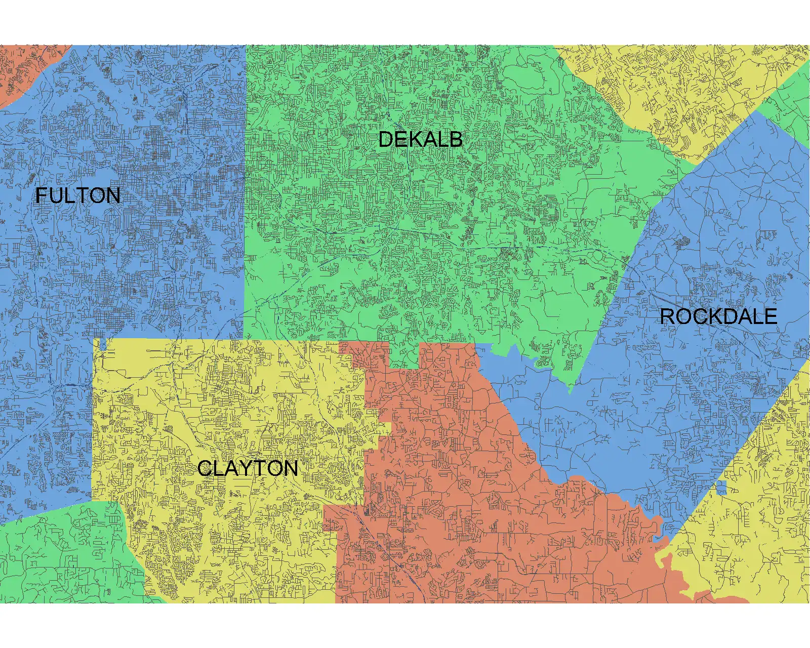
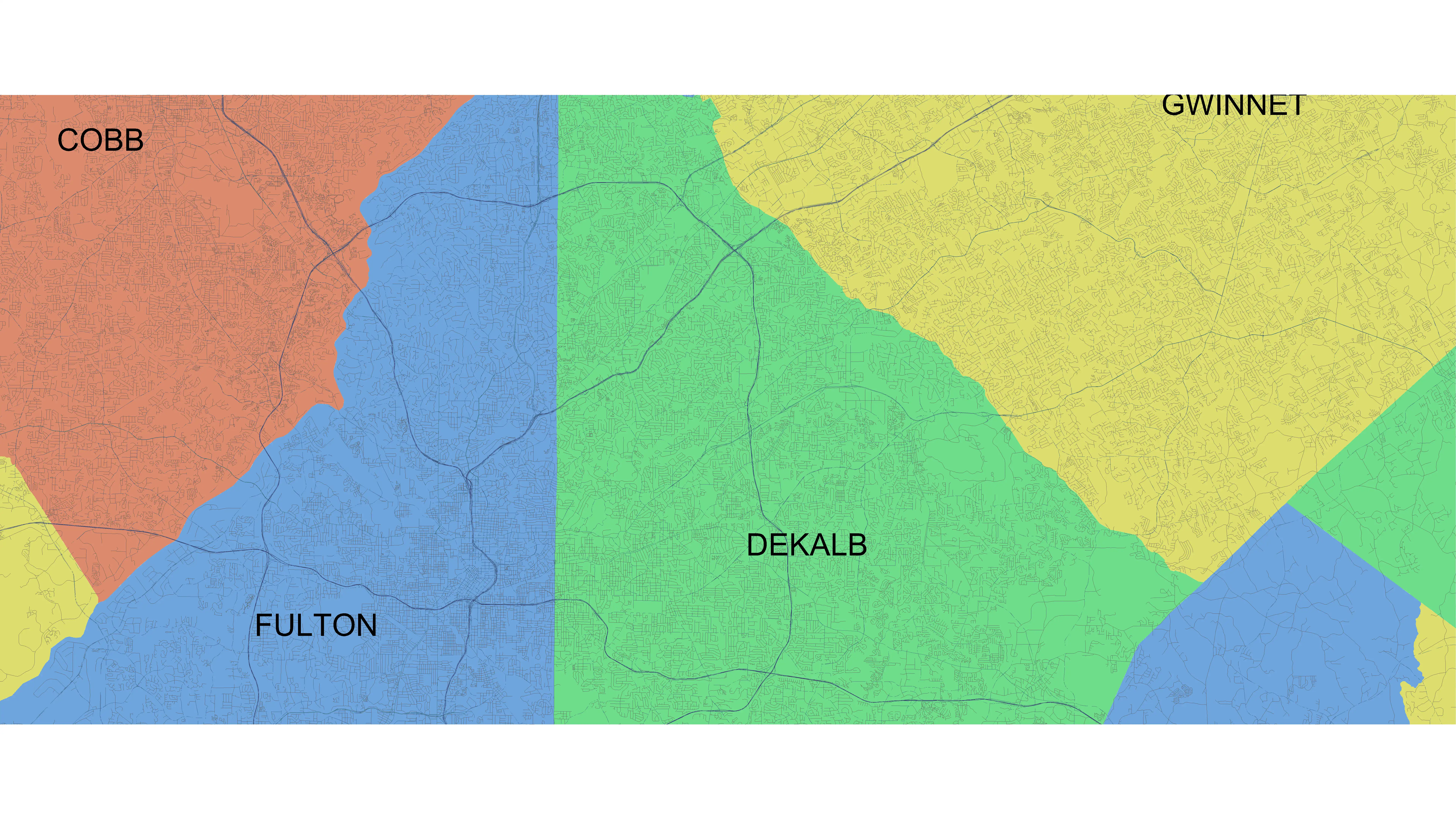
Additionally, Vicinity GIS includes Governmental Administrative divisions such as State, Province, County/Parish, and City. These divisions are separated by hatched areas, making them easily distinguishable and searchable within the model. By incorporating these administrative boundaries, users can create designs that accurately reflect the real-world context of their projects.
(Image by: Methodical, Cad Consulting)
Seamless Integration and User-Friendly Interface
Despite its advanced features, Vicinity GIS - Indiana, US is designed with user-friendliness in mind. The plugin seamlessly integrates with Revit, allowing users to incorporate geo-referenced CAD Models with ease. Whether you are a seasoned Revit user or new to the software, Vicinity GIS offers a straightforward interface that simplifies the design process.
Furthermore, the plugin's compatibility with Autodesk® products ensures that users can leverage its features across a wide range of design projects. Whether you are working on architectural plans, structural layouts, or geographic designs, Vicinity GIS provides the tools you need to bring your vision to life.
(Image by: Methodical, Cad Consulting)
Conclusion
Vicinity GIS - Indiana, US is a powerful Revit plugin that offers a wealth of features for enhancing design projects with real-world geographic elements. From geo-referenced CAD Models to detailed design elements, this plugin provides users with the tools they need to create accurate and visually appealing designs. Whether you are a seasoned professional or new to Revit, Vicinity GIS offers a user-friendly interface that simplifies the design process. If you are looking to take your projects to the next level, consider incorporating Vicinity GIS into your workflow.