


About this app
Introduction
Vicinity GIS is a game-changer in the world of Revit design, offering a collection of CAD Models that are geo-referenced to real-world features such as Federal, State, and local streets, highways, and roads. This plugin provides an invaluable resource for architects, engineers, and designers looking to integrate accurate geographic data into their projects seamlessly. By utilizing geo-referenced CAD Models in NAD83 State Plane coordinate systems, Vicinity GIS ensures precision and consistency in all design endeavors.
(Image by: Methodical, Cad Consulting)
Features and Functionality
One of the standout features of Vicinity GIS is its compatibility with all Autodesk product categories, thanks to its use of the universally recognized "dwg" format. This allows users to easily insert or x-reference CAD Models into their project design models, streamlining the integration of geographic data. The plugin also offers the flexibility to x-clip specific areas of interest, ensuring that only relevant information is displayed in the design.
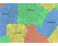
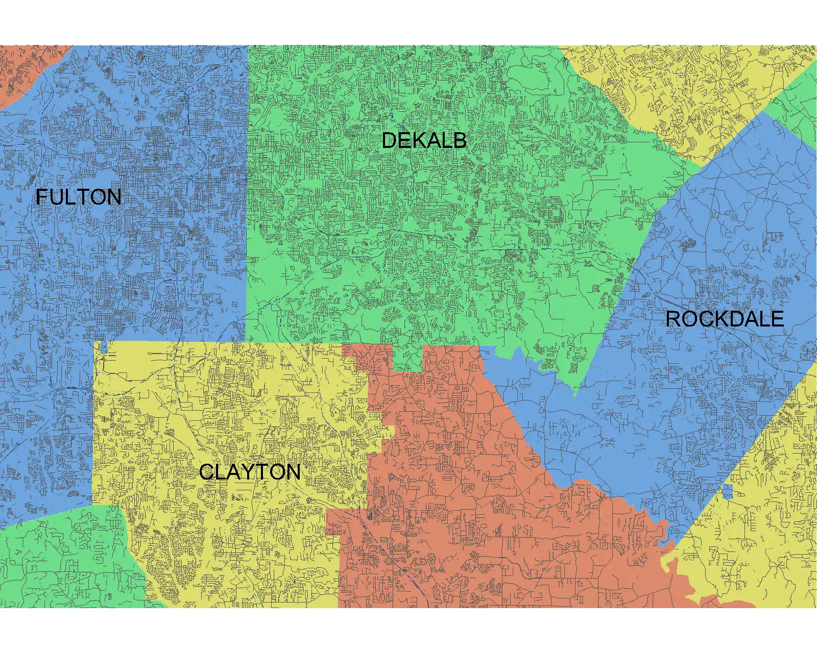
Each CAD Model in Vicinity GIS is meticulously organized, with features such as polylines, text, and hatch entities separated by Layer, Color, Line Weight, and Style. This level of detail allows users to isolate, select, and search for specific features using standard Autodesk AutoCAD commands like "Qselect" and "Find" for text entities. Additionally, the inclusion of Governmental Administrative divisions such as State, Province, County/Parish, and City, delineated by hatched areas, makes it easy to distinguish and search for specific geographic regions within the CAD Models.
(Image by: Methodical, Cad Consulting)
Benefits for Users
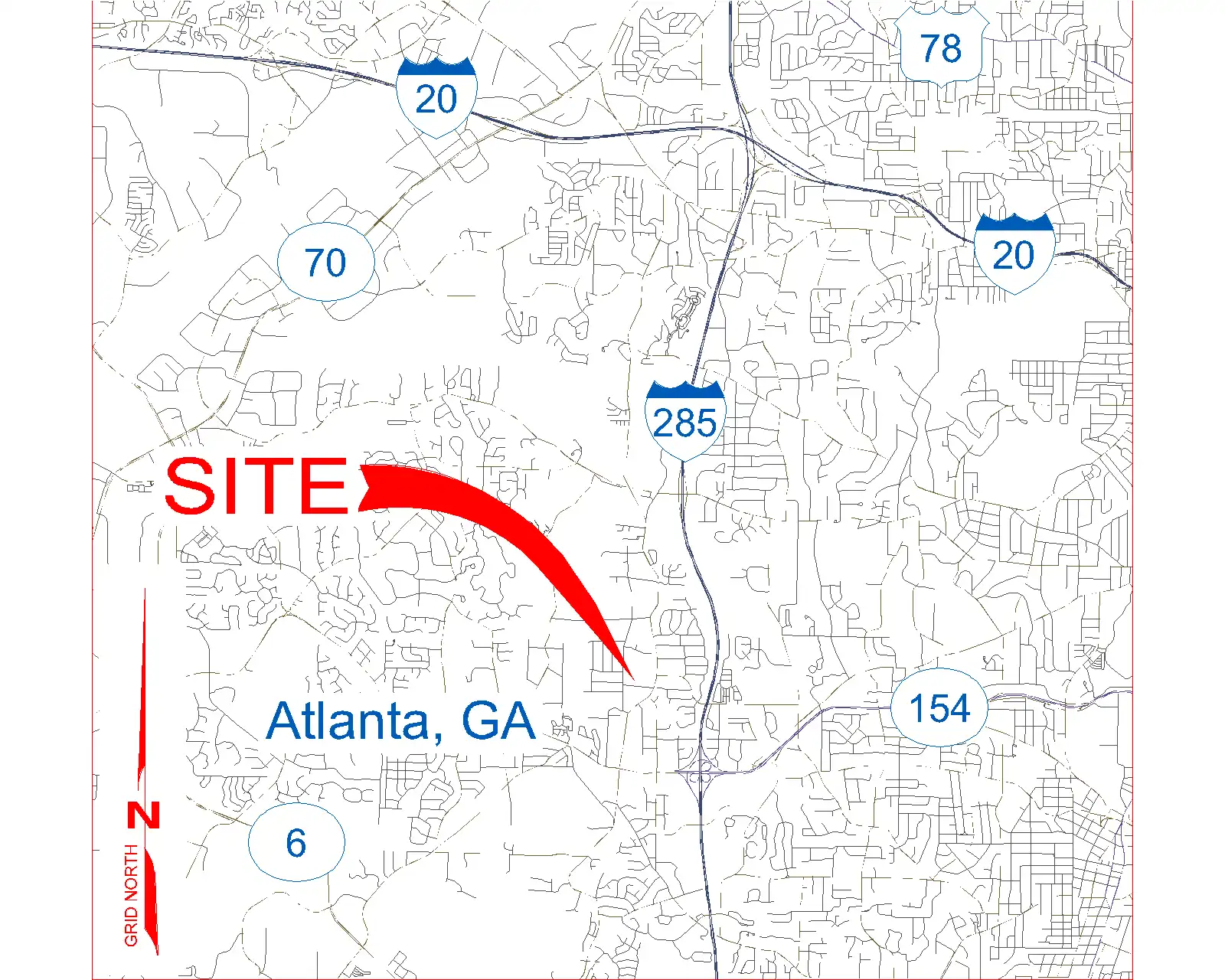
For users in the United States and other countries that utilize the Imperial System, Vicinity GIS provides CAD Models in U.S. Survey feet, ensuring compatibility with local standards and units. Similarly, for countries that use the Metric System, CAD Models are available in meters, catering to a diverse global user base. This versatility makes Vicinity GIS a valuable tool for designers working on projects across borders and regions.
Furthermore, the geo-referenced nature of the CAD Models in Vicinity GIS enhances the accuracy and reliability of design projects. By integrating real-world features such as streets, highways, and roads directly into the design process, users can create more informed and precise architectural, engineering, and structural models. This level of detail not only improves the overall quality of designs but also speeds up the workflow by eliminating the need for manual data input and verification.
(Image by: Methodical, Cad Consulting)
Conclusion
Vicinity GIS - South Carolina, US is a must-have plugin for Revit users looking to elevate their design capabilities with geo-referenced CAD Models. With its seamless integration into Autodesk products, meticulous organization of features, and compatibility with global units, Vicinity GIS offers a comprehensive solution for incorporating real-world geographic data into design projects. Whether you're working on architectural, engineering, or structural designs, this plugin provides the tools you need to enhance precision, efficiency, and overall project quality. Try Vicinity GIS today and experience the future of Revit design.
(Image by: Methodical, Cad Consulting)