


About this app
If you are a Revit user looking to enhance your design projects with real-world, geo-referenced features, look no further than Vicinity GIS - Tennessee, US. This plugin offers a collection of CAD Models that accurately represent Federal, State, and local streets, highways, and roads. With each CAD Model geo-referenced to its respective NAD83 State Plane coordinate system, you can ensure precise alignment and accuracy in your designs.
Features and Compatibility
One of the standout features of Vicinity GIS - Tennessee, US is its compatibility with all Autodesk® product categories. The plugin provides CAD Models in "dwg" format, which has become the universal standard in Engineering, Architectural, Structural, and Geographic industries. Whether you are working on a civil engineering project, an architectural design, or a geographic analysis, these CAD Models can seamlessly integrate into your workflow.
Moreover, the CAD Models are available in U.S. Survey feet for the United States and countries that use the Imperial System, as well as meters for countries that use the Metric System. This flexibility allows users from around the world to leverage the plugin's capabilities and enhance the accuracy of their designs.
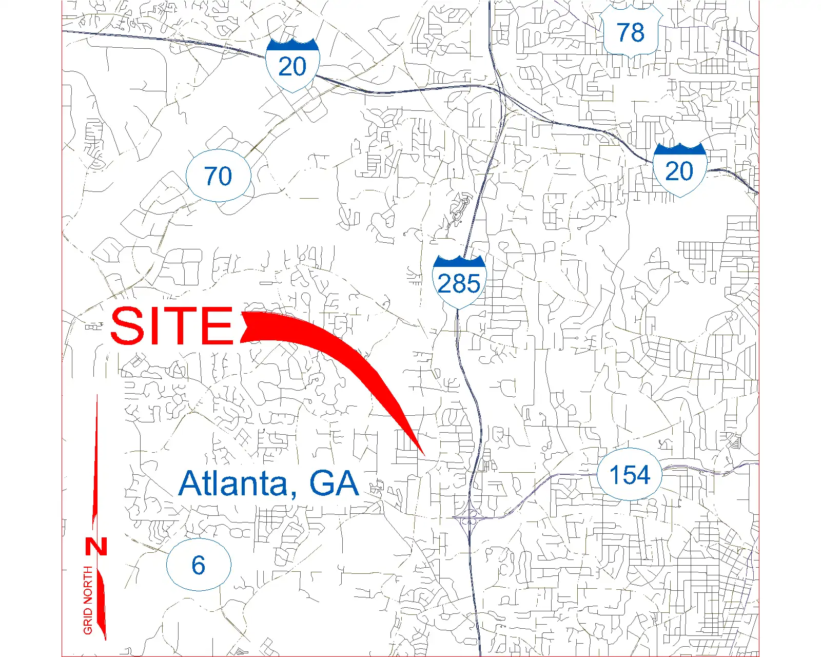
(Image by: Methodical, Cad Consulting)
Functionality and User Experience
When it comes to functionality, Vicinity GIS - Tennessee, US excels in providing users with a streamlined experience. The CAD Models include polylines, text, and hatch entities that are organized by Layer, Color, Line Weight, and Style. This level of detail and organization makes it easy for users to isolate, select, and search for specific features within the models.
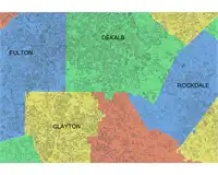
Additionally, the plugin includes Governmental Administrative divisions such as State, Province, County/Parish, and/or City, which are delineated by hatched areas. This feature not only makes it easier to distinguish between different administrative regions but also enhances the searchability of specific areas within the models.
(Image by: Methodical, Cad Consulting)
Installation and Usage
It is important to note that Vicinity GIS - Tennessee, US utilizes a dwg file for installation, rather than the standard App Store installer. While this may require an additional step in the installation process, it is a minor inconvenience considering the powerful functionality and features that the plugin offers.
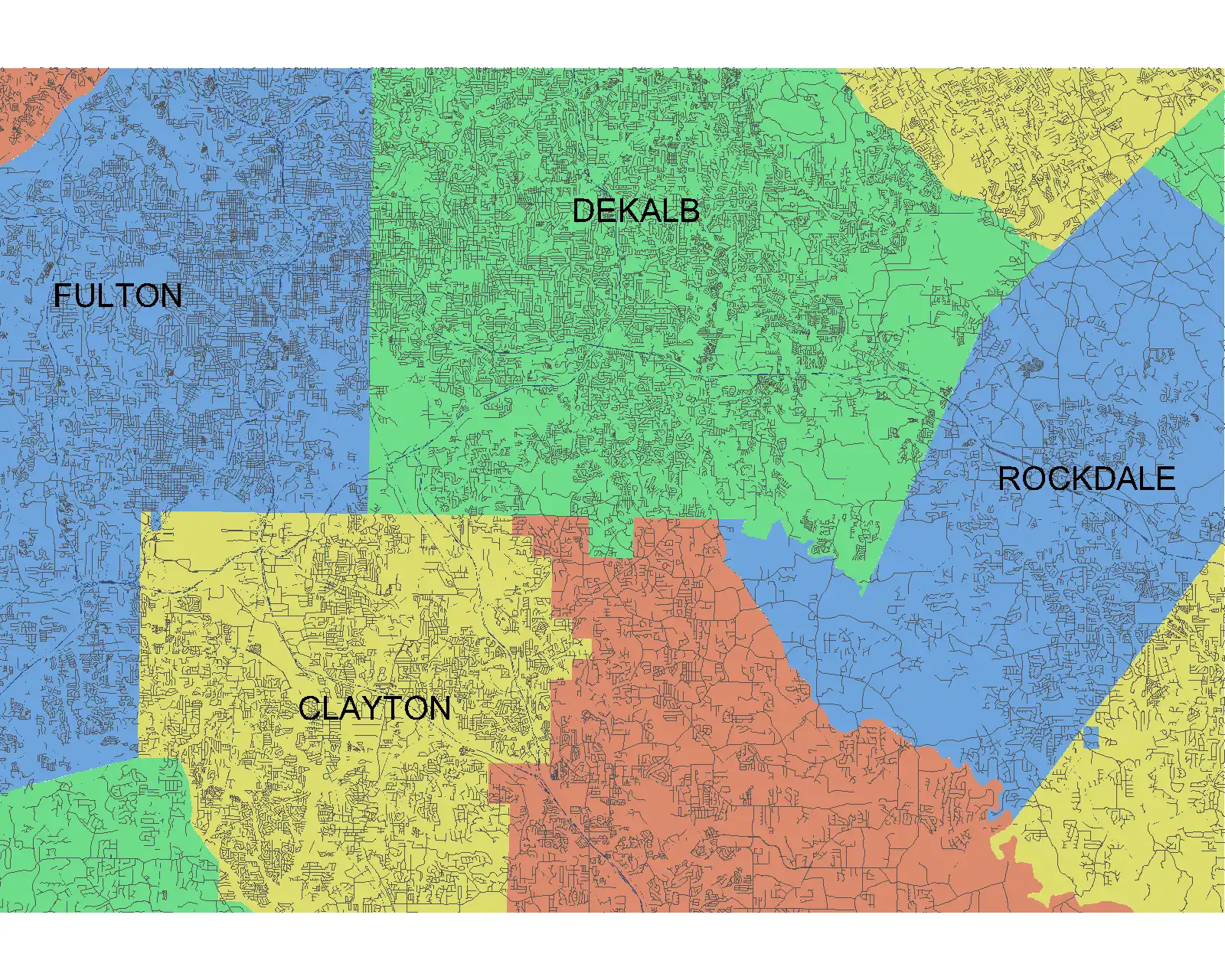
Once installed, users can easily insert or x-reference the CAD Models into their project design models. The models can also be x-clipped to show only the project-specific areas that are needed, allowing for a more focused and efficient design process. With standard Autodesk® AutoCAD® commands like "Qselect" and "Find" for text entities, users can quickly navigate and manipulate the CAD Models to suit their design requirements.
(Image by: Methodical, Cad Consulting)
Conclusion
Vicinity GIS - Tennessee, US is a valuable plugin for Revit users who are looking to enhance the accuracy and detail of their design projects. With geo-referenced CAD Models that represent real-world features with precision, users can streamline their workflow and improve the overall quality of their designs. Whether you are working on a civil engineering project, an architectural design, or a geographic analysis, this plugin offers a versatile solution that caters to a wide range of industries and design requirements.
Overall, Vicinity GIS - Tennessee, US is a highly recommended plugin that combines functionality, compatibility, and user experience to deliver a comprehensive solution for integrating real-world features into Revit designs. Give it a try and experience the benefits of enhanced accuracy and efficiency in your design projects.
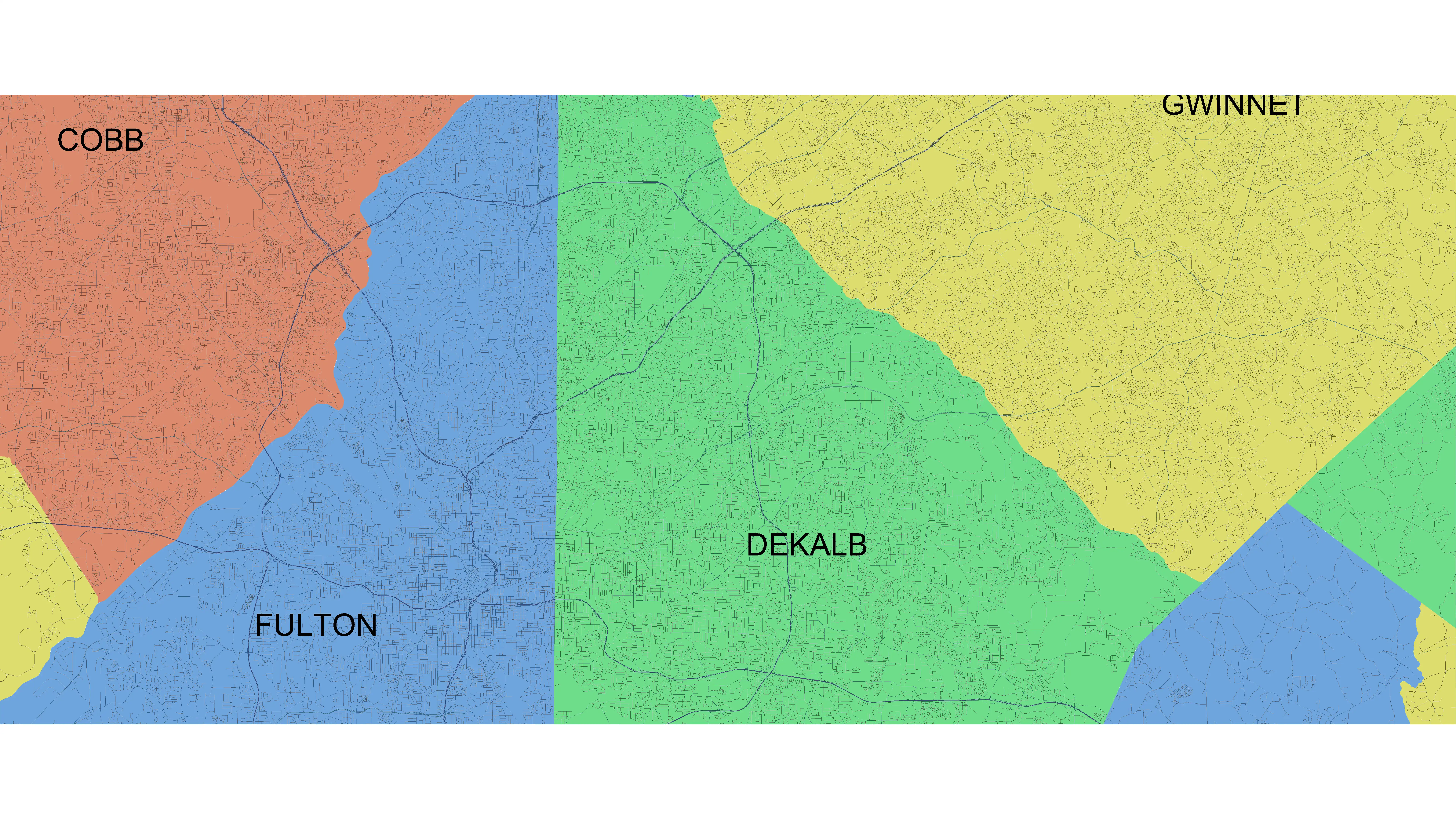
(Image by: Methodical, Cad Consulting)


